9 Best National and State Parks in Arizona
Complete guide to 9 best national and state parks in arizona. Detailed information, recommendations, and everything you need to know

Arizona's diverse landscape offers some of the most spectacular natural experiences in the United States, from world-famous canyons carved by ancient rivers to mysterious underground caverns and towering saguaro forests. Each park tells a unique story of geological forces, desert resilience, and natural beauty that has captivated visitors for generations. Whether you're planning a multi-day adventure or looking for accessible day trips, these nine outstanding parks showcase Arizona's incredible range of ecosystems and landscapes. From the iconic red rocks of Sedona to hidden natural bridges tucked away in pine forests, you'll discover everything needed to plan memorable visits to these remarkable destinations.
Grand Canyon National Park
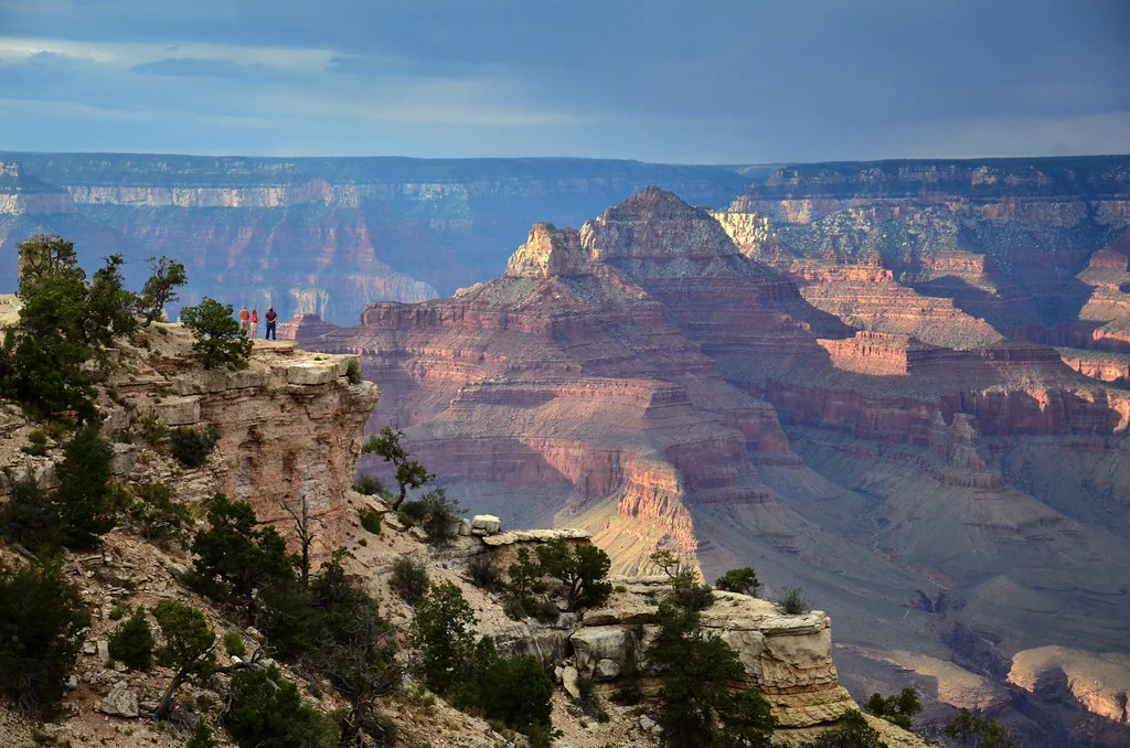
Standing at the rim of this magnificent chasm, visitors experience one of Earth's most dramatic geological displays - a mile-deep canyon stretching 277 river miles across northern Arizona. The stunning vista reveals nearly two billion years of Earth's history in layered rock formations painted in brilliant reds, oranges, and purples that shift with changing light throughout the day.
The South Rim remains open year-round and offers the most accessible viewpoints and visitor services. Popular stops include Mather Point, Yavapai Observation Station, and Hermit's Rest, each providing unique perspectives of the canyon's immensity. The South Rim Village houses visitor centers, restaurants, lodging, and gift shops, making it ideal for first-time visitors or those with limited mobility.
Adventure-seekers can tackle the challenging Bright Angel Trail or South Kaibab Trail, but remember that hiking down is optional - hiking back up is mandatory. Summer temperatures at the canyon bottom can exceed 110°F, making spring and fall optimal for serious hiking. Always carry plenty of water, start early, and know your limits.
The North Rim, open May through October, offers a quieter, more wilderness-focused experience with dramatic viewpoints like Angel's Window and Cape Royal. Located 1,000 feet higher than the South Rim, it provides cooler temperatures and different perspectives of the canyon's northern formations.
Entry costs $35 per vehicle (valid for seven days), with annual Grand Canyon passes available for $70. The America the Beautiful Annual Pass ($80) covers all national parks and represents excellent value for multi-park visits. Make lodging reservations well in advance, especially for South Rim accommodations, which book months ahead during peak seasons.
Petrified Forest National Park
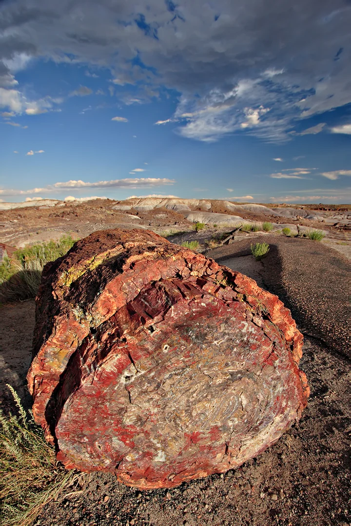
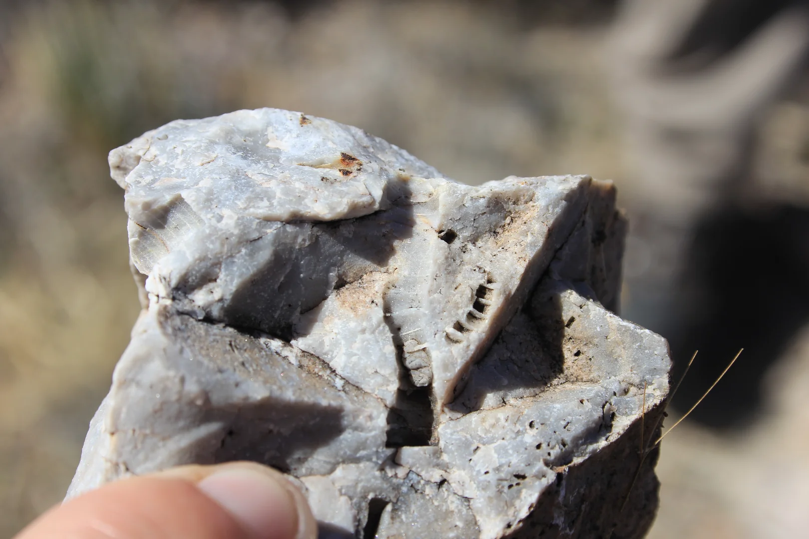
This remarkable landscape preserves one of the world's largest concentrations of petrified wood, where ancient trees from 225 million years ago have transformed into brilliant crystalline stone. The park's 28-mile scenic drive connects numerous pull-offs and short trails, making it accessible for visitors of all mobility levels while showcasing both petrified logs and stunning Painted Desert vistas.
The northern section features the Painted Desert, where layered sedimentary rocks create a palette of reds, blues, purples, and grays that shift dramatically with lighting conditions. Early morning and late afternoon provide the most spectacular colors, when low-angle sunlight illuminates the badlands terrain. The Painted Desert Inn, a historic 1930s building, serves as a museum and offers panoramic views across this colorful landscape.
Southern areas contain the park's most impressive petrified wood concentrations, including the famous Crystal Forest and Giant Logs trails. These easy walks lead to massive fossilized trees, some measuring over 100 feet in original length. The Rainbow Forest Museum explains the fossilization process and displays polished cross-sections revealing the intricate mineral patterns within.
Archaeological sites throughout the park preserve evidence of ancient Puebloan cultures, including petroglyphs at Newspaper Rock and pueblo ruins at Puerco Pueblo. These 800-year-old sites demonstrate how indigenous peoples adapted to this challenging desert environment.
The park charges $25 per vehicle for seven-day access, with no lodging available inside park boundaries. Holbrook, 20 miles west, provides the nearest accommodations and services. Visit during spring or fall for comfortable temperatures and optimal photography conditions. Summer brings intense heat and afternoon thunderstorms, while winter can bring snow and icy conditions to this high desert environment at 5,400 feet elevation.
Saguaro National Park
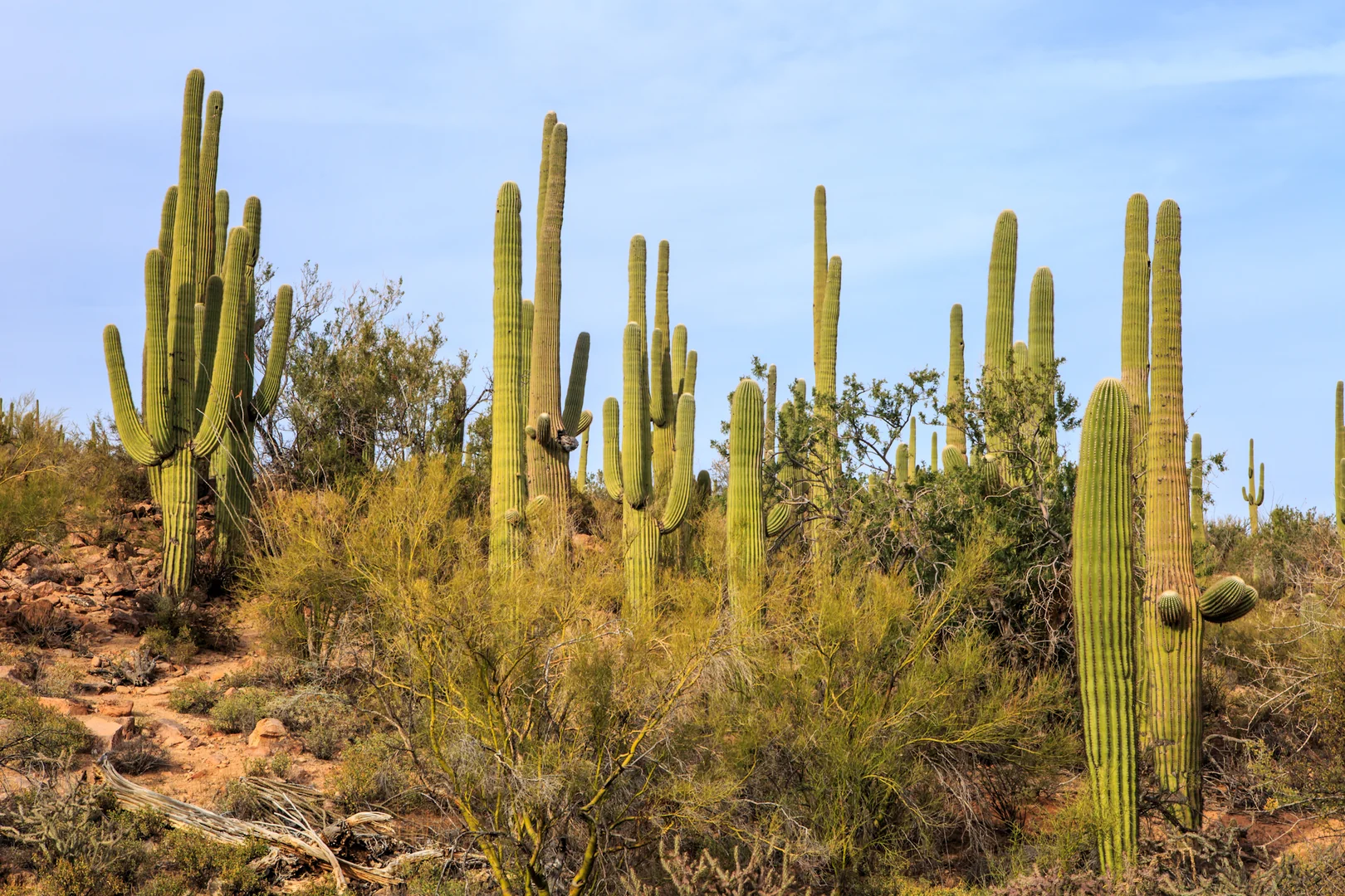
Split into two districts flanking Tucson, this park protects North America's most iconic desert landscape, where towering saguaro cacti create forests unlike anywhere else on Earth. These majestic giants, reaching heights of 40-60 feet and living up to 200 years, dominate landscapes filled with diverse desert plants and wildlife adapted to extreme conditions.
The Tucson Mountain District (west) offers easier access and more dramatic saguaro concentrations along the scenic Bajada Loop Drive, a six-mile unpaved road suitable for most vehicles. This area showcases classic Sonoran Desert scenery with dense saguaro stands backed by rugged mountain peaks. The Desert Discovery Trail provides wheelchair-accessible introduction to desert ecology, while the Valley View Overlook Trail rewards moderate hikers with sweeping vistas.
Rincon Mountain District (east) features higher elevations and more challenging terrain, where desert gives way to pine forests at higher altitudes. The Cactus Forest Drive, a paved eight-mile loop, passes through one of the country's densest saguaro forests. Numerous trailheads provide access to both easy nature walks and strenuous mountain hikes reaching elevations above 8,000 feet.
Wildlife viewing opportunities abound, especially during cooler morning and evening hours. Javelinas, coyotes, roadrunners, and numerous bird species including Gila woodpeckers and elf owls make their homes among the cacti. Spring brings spectacular wildflower displays, while late April and May feature saguaro blooms - Arizona's state flower.
Entry fees are $25 per vehicle for seven days, with both districts accessible from Tucson within 30 minutes. Visit between November and April for comfortable temperatures, as summer days regularly exceed 100°F. Carry plenty of water, wear sun protection, and stay on designated trails to protect fragile desert vegetation and avoid dangerous wildlife encounters.
Slide Rock State Park
Nestled in Oak Creek Canyon between Flagstaff and Sedona, this popular park centers around a natural water slide carved through smooth red sandstone by Oak Creek's flowing waters. The 80-foot-long natural chute provides refreshing relief from Arizona heat, making it a beloved destination for families and adventure-seekers alike.
The park preserves the historic Pendley Homestead, a working apple orchard established in 1910 that continues producing fruit today. Visitors can explore the original farmhouse, barn, and irrigation systems while learning about early settlement challenges in this remote canyon. The heritage apple orchard contains varieties rarely found elsewhere, with fresh apples available for purchase during harvest season.
Oak Creek flows year-round through the park, creating swimming holes, gentle rapids, and the famous sliding rock formation. Water temperatures remain cool even in summer, providing welcome relief when desert temperatures soar. The natural slide requires careful navigation - smooth rock surfaces can be slippery, and creek depths vary seasonally.
Multiple hiking trails explore the surrounding red rock landscape, including paths leading to secluded swimming spots away from main crowds. The Slide Rock Trail follows the creek upstream through towering canyon walls, while shorter walks explore the orchard area and historic buildings.
This extremely popular destination charges $30 per vehicle on weekends and holidays, $20 on weekdays, with fees varying seasonally. Arrive early during summer months, as the small parking area fills quickly by mid-morning. The park often reaches capacity on hot weekends, requiring visitors to wait for parking spaces. Swimming and sliding are at your own risk - creek conditions change rapidly, and no lifeguards are present.
Kartchner Caverns State Park
This underground wonderland protects one of the world's longest and most pristine cave systems, discovered in 1974 but kept secret for 14 years while scientists studied its remarkable formations. The living cave continues growing today, with guided tours revealing massive rooms filled with intricate stalactites, stalagmites, flowstone, and other geological wonders formed over 200,000 years.
Two distinct tour options showcase different cave sections and seasonal features. The Rotunda/Throne Room Tour operates year-round, leading visitors through massive chambers including the 58-foot-tall Kubla Khan formation, one of the world's tallest cave columns. This 50-minute tour covers about half a mile on paved, well-lit pathways suitable for most fitness levels.
The Big Room Tour, available October through mid-April, explores the cave's largest chamber - longer than two football fields and taller than a six-story building. This seasonal restriction protects the endangered cave myotis bats that roost here during warmer months. The 105-minute tour covers more challenging terrain but reveals stunning formations including 21-foot-tall soda straws and massive flowstone cascades.
Temperature inside remains constant at 68°F year-round, making light jackets advisable. Humidity approaches 99%, helping preserve delicate formations but creating a unique environment unlike typical Arizona destinations. Photography is strictly prohibited to protect cave formations from camera flashes.
Advanced reservations are essential, as tours frequently sell out weeks or months ahead. Tour prices range from $23-27 for adults, with park entry fees of $7 per vehicle additional. The Discovery Center features exhibits about cave geology, bat ecology, and Arizona wildlife. Camping facilities and hiking trails provide additional activities for extended visits.
Tonto Natural Bridge State Park
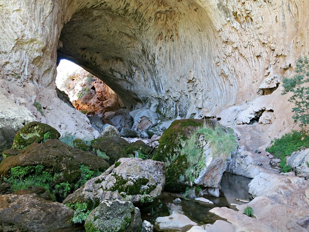
Hidden in a narrow canyon 10 miles northwest of Payson, this remarkable natural bridge stands as the world's largest natural travertine bridge. The 183-foot-high, 400-foot-long span was formed by thousands of years of mineral-rich spring water deposits, creating a unique geological formation found nowhere else at this scale.
Four different viewpoints provide varying perspectives of this massive formation. The viewpoint trail offers wheelchair-accessible overlooks from above, while more adventurous visitors can hike beneath the bridge through cool, shaded canyons. The Pine Creek Trail descends into the canyon for close-up views of the bridge's underside, where temperatures remain notably cooler even on hot summer days.
The park's elevation at 4,500 feet creates a unique microclimate supporting vegetation typically found in more northern regions. Ponderosa pines, Douglas firs, and oak trees thrive alongside desert plants, creating diverse habitats supporting varied wildlife. Springs flowing year-round beneath the bridge support lush vegetation and provide habitat for numerous bird species.
The historic Gowan Lodge, built in the 1920s, serves as the visitor center and showcases the area's tourism history. Early visitors reached this remote location via stagecoach, staying in rustic accommodations while marveling at the natural wonder. Today's facilities include picnic areas, restrooms, and interpretive displays explaining the bridge's formation.
Entry costs $7 per vehicle, with the park typically open daily except during extreme weather conditions. The narrow, winding access road requires careful driving but is suitable for most vehicles. Summer temperatures remain moderate due to elevation and shade, making this an excellent escape from lower desert heat. Winter brings occasional snow, potentially closing access roads temporarily.
Catalina State Park
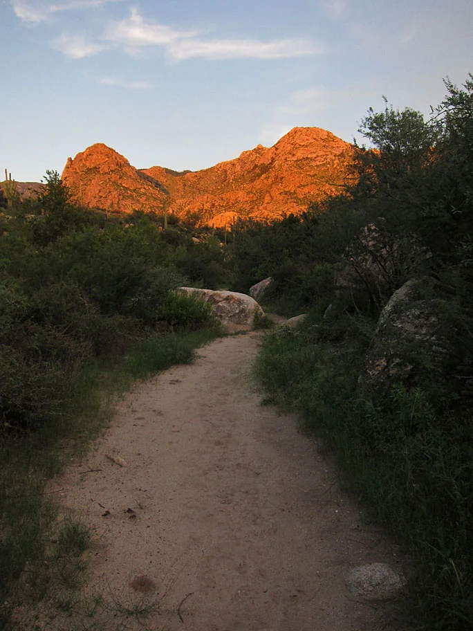
Situated at the base of the dramatic Santa Catalina Mountains north of Tucson, this park showcases classic Sonoran Desert landscape punctuated by seasonal Sutherland Wash and diverse hiking opportunities. The 5,500-acre park protects pristine desert habitat while providing accessible outdoor recreation just minutes from urban areas.
More than 5,000 saguaro cacti dot the landscape, along with palo verde, ocotillo, and numerous other desert plants creating textbook examples of Sonoran Desert ecology. Wildlife viewing opportunities abound, with frequent sightings of javelinas, coyotes, roadrunners, and over 150 bird species including colorful vermillion flycatchers and curve-billed thrashers.
The park's 15 miles of trails accommodate various skill levels and interests. The Nature Trail provides an easy introduction to desert ecology, while the Romero Canyon Trail leads toward dramatic mountain vistas and seasonal waterfalls during wet periods. More challenging routes connect to the extensive Catalina Mountains trail system, including paths leading toward 9,000-foot peaks.
Sutherland Wash flows seasonally through the park, creating riparian habitat that attracts different wildlife species and supports cottonwoods and willows. During winter months, this wash may flow continuously, while summer brings flash flood potential during monsoon storms.
The park offers 120 campsites with hookups for RVs up to 40 feet, plus group camping areas and equestrian facilities. Day-use fees are $7 per vehicle, with camping rates starting at $30 per night. The stunning vista of saguaros silhouetted against mountain peaks creates exceptional photography opportunities, especially during golden hour lighting.
Visit October through April for optimal temperatures and wildlife activity. Summer brings extreme heat but also spectacular monsoon storms and desert wildflower displays following wet periods.
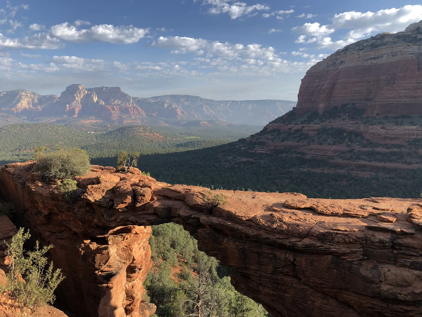
Red Rock State Park
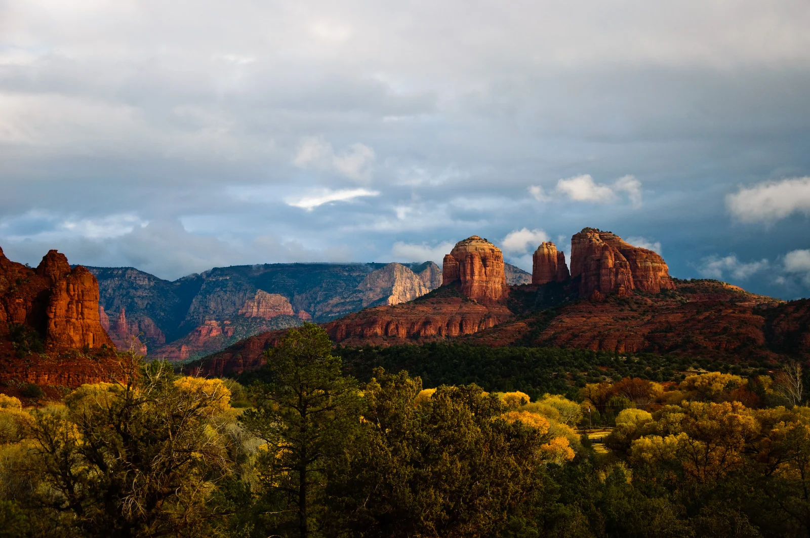
Located in Oak Creek's riparian corridor just outside Sedona, this 286-acre park preserves crucial wildlife habitat while providing educational programs and gentle trails showcasing the famous red rock formations. Unlike Sedona's busier tourist areas, the park emphasizes environmental education and habitat protection over recreation.
Oak Creek flows year-round through the park, supporting cottonwoods, willows, and Arizona sycamores that create lush green corridors contrasting dramatically with surrounding red sandstone cliffs. This riparian ecosystem attracts over 200 bird species, making it one of Arizona's premier birding destinations. Great blue herons, vermillion flycatchers, and numerous waterfowl species frequent the creek areas.
Five miles of interconnecting trails explore diverse habitats from creek-side walks to moderate climbs providing elevated views of Sedona's iconic formations including Cathedral Rock and Bell Rock. The Smoke Trail leads to panoramic viewpoints, while the Creek-side Trail follows Oak Creek through shaded corridors perfect for hot-weather hiking.
The visitor center houses extensive exhibits about local ecology, geology, and wildlife, plus offers regularly scheduled guided walks, bird watching tours, and evening programs. Educational programs target various ages and interests, from children's nature activities to advanced naturalist workshops.
Unlike surrounding areas, motorized recreation and swimming are prohibited, creating peaceful environments for wildlife observation and contemplative experiences. This focus on preservation means smaller crowds and better wildlife viewing opportunities compared to busier Sedona attractions.
Entry fees are $7 per vehicle, with the park open daily from 8 AM to 5 PM (6 PM during summer months). No camping is available, but nearby Sedona provides extensive lodging options. The Red Rock State Park, AZ showcases the perfect balance between accessibility and conservation that makes this destination special for nature enthusiasts.
Chiricahua National Monument
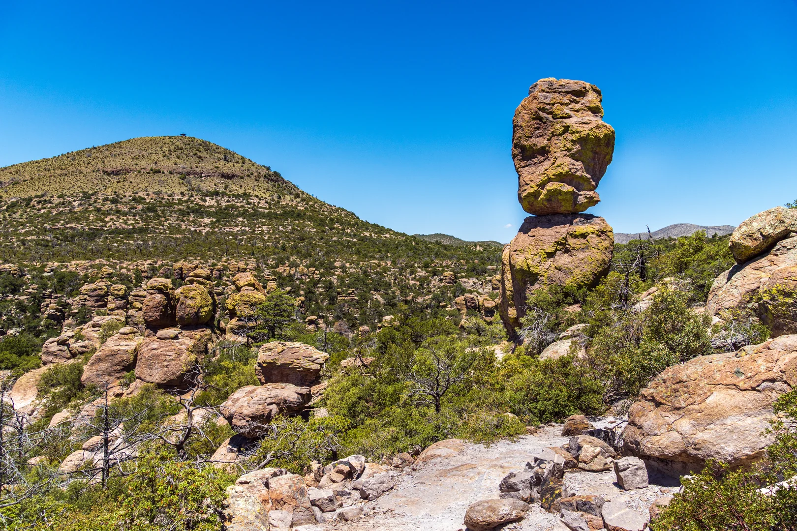
Rising dramatically from surrounding grasslands in southeastern Arizona, this "Wonderland of Rocks" protects extraordinary volcanic rock formations created by massive eruptions 27 million years ago. Weathering and erosion have carved these rhyolite deposits into towering spires, balanced rocks, and narrow canyons creating landscapes that seem almost otherworldly.
The monument's 8-mile scenic drive climbs from desert grasslands at 5,400 feet to forested highlands above 6,800 feet, passing numerous trailheads and viewpoints showcasing different aspects of the rock formations. Massai Point provides panoramic views across the entire monument, while Sugarloaf Mountain offers 360-degree vistas extending into Mexico and New Mexico.
More than 17 miles of hiking trails explore slot canyons, dense forests, and rock formations with evocative names like Duck on a Rock, Punch and Judy, and Big Balanced Rock. The Echo Canyon Trail, the monument's most popular hike, winds through towering rock corridors and chambers with exceptional acoustics. More challenging routes like the Heart of Rocks Loop require greater endurance but reward hikers with the monument's most spectacular formations.
This "Sky Island" ecosystem supports remarkable biodiversity, with elevation changes creating habitats from Sonoran Desert through pine-oak woodlands. The area harbors numerous endemic species and serves as the northernmost range for many Mexican species, creating unique wildlife viewing opportunities.
The Chiricahua National Monument, Arizona, USA 2024 32 landscape represents one of Arizona's most remarkable yet lesser-known destinations. Entry costs $25 per vehicle for seven days, with the monument open year-round though winter weather can temporarily close higher elevation roads. Willcox, 36 miles northwest, provides the nearest lodging and services, making this a perfect addition to southeastern Arizona itineraries exploring this region's unique natural and cultural attractions.


